File:Palestine malaria spleen enlargement rates 1920.jpg
Original file (2,592 × 4,188 pixels, file size: 690 KB, MIME type: image/jpeg)
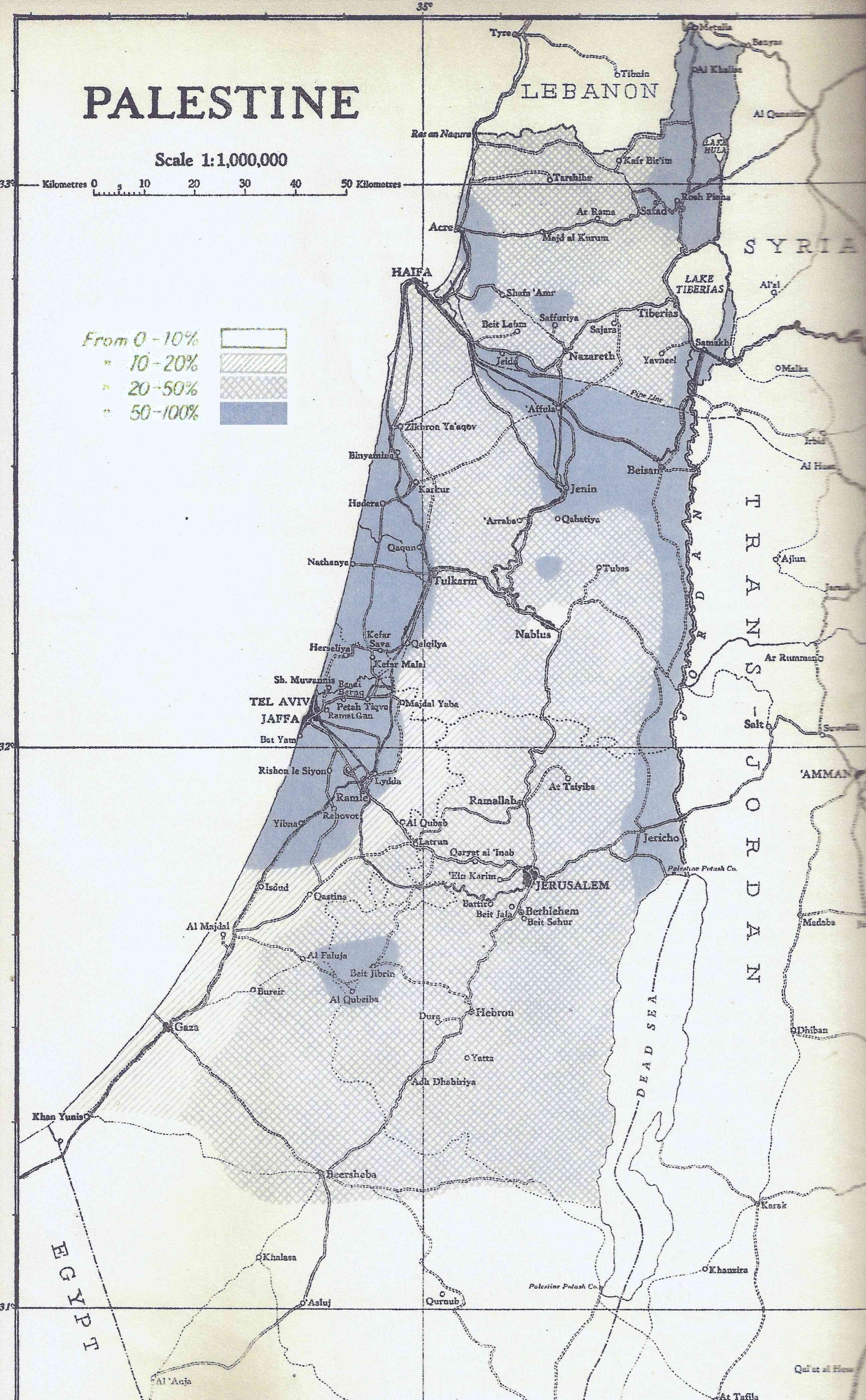
Historical map of Palestine showing spleen enlargement rates in 1920, a proxy used at the time for malaria endemicity. The legend distinguishes 0–10%, 10–20%, 20–50% and 50–100% spleen-rate areas. These percentages are not the proportion of land privately owned or the proportion of land uninhabited.
Original source: Palestine Department of Health, A Review of the Control of Malaria in Palestine (1918–1941), Government Printing Press, Jerusalem, 1941. Reproduction: Florence V. Dunkel and Anton Alexander, Three stepping stones leading to malaria elimination, changing world maps on the way, MalariaWorld Journal 11:4 (2020), Figure 4.
Original government map: public domain, expired Crown copyright. Reproduced figure supplied under Creative Commons Attribution 3.0 by Dunkel and Alexander. Extracted from the publisher's PDF as the original embedded JPEG, without alteration.
File history
Click on a date/time to view the file as it appeared at that time.
| Date/Time | Thumbnail | Dimensions | User | Comment | |
|---|---|---|---|---|---|
| current | 20:24, 12 November 2026 | | 2,592 × 4,188 (690 KB) | Quill (talk | contribs) | Add the historical malaria spleen-rate map with Department of Health source and reproduction credits. |
You cannot overwrite this file.
Links
The following pages link to this file: