File:Palestine Mean Annual Rainfall - Survey of Palestine 1946.jpg
Original file (3,754 × 7,147 pixels, file size: 5.93 MB, MIME type: image/jpeg)
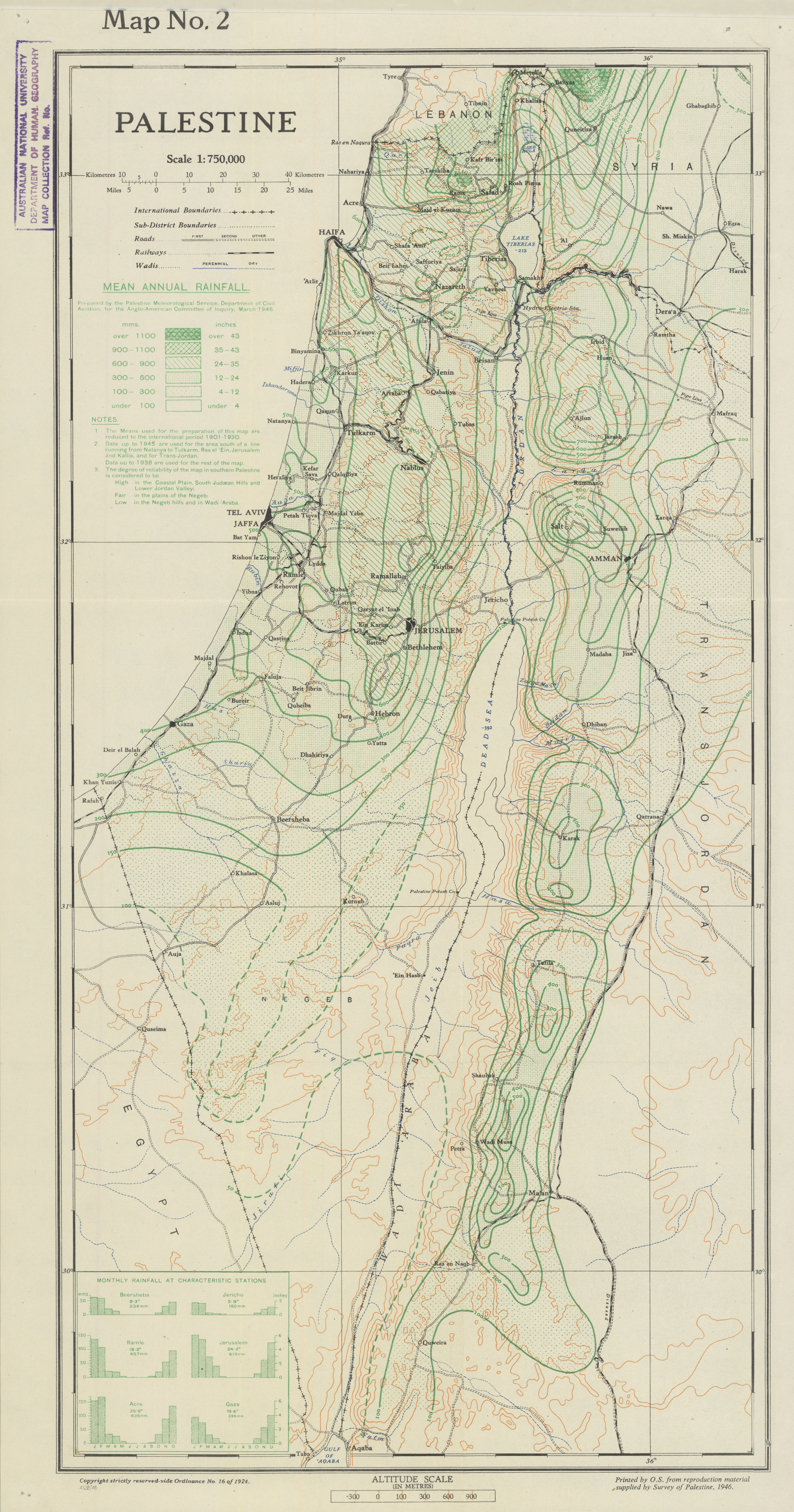
Palestine: Mean Annual Rainfall. Map No. 2, scale 1:750,000. Prepared by the Palestine Meteorological Service, Department of Civil Aviation, for the Anglo-American Committee of Inquiry, March 1946. Printed by the Ordnance Survey from reproduction material supplied by the Survey of Palestine, 1946.
The map shows mean annual rainfall in millimetres and inches, with contours and rainfall categories. The notes describe data periods and lower reliability in parts of the Negev and Wadi Araba. It is a historical climate map, not a map of land ownership.
Source: Australian National University, ANU Asia-Pacific Map Collection, item 1885/199050. Reproduced without alteration. Public domain: UK Government artistic work published in 1946; the Crown copyright term has expired.
File history
Click on a date/time to view the file as it appeared at that time.
| Date/Time | Thumbnail | Dimensions | User | Comment | |
|---|---|---|---|---|---|
| current | 20:21, 12 November 2026 | | 3,754 × 7,147 (5.93 MB) | Quill (talk | contribs) | Add the 1946 rainfall map with historical climate legend, government credits and source. |
You cannot overwrite this file.
Links
The following pages link to this file: