File:Jewish land possession 1944 with 1947 proposed state outline.png
Original file (2,000 × 3,616 pixels, file size: 7.98 MB, MIME type: image/png)
Description
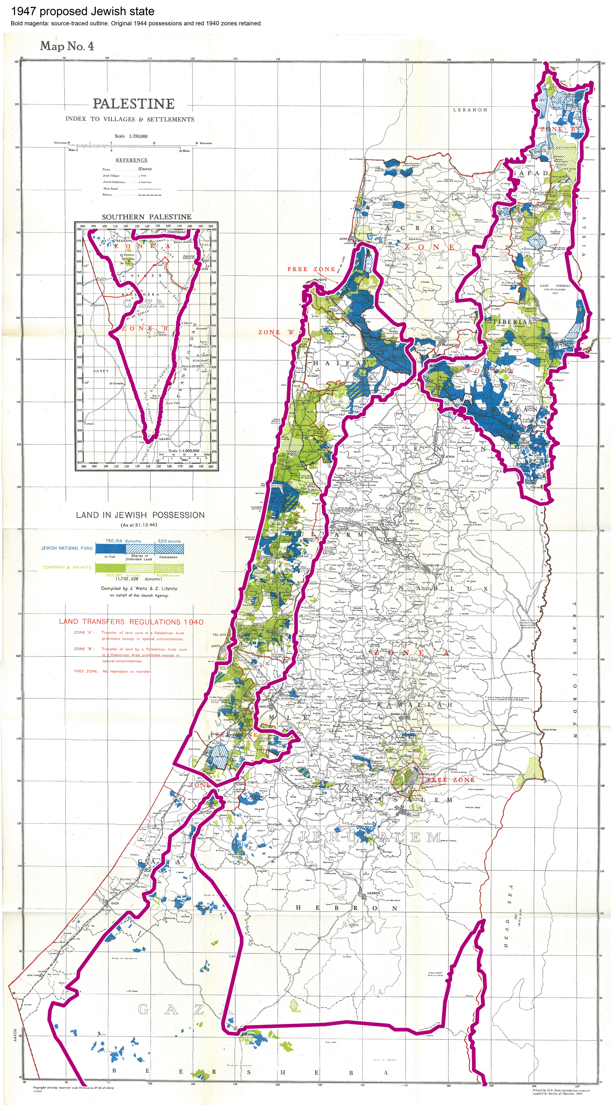
Jewish land in possession on 31 December 1944, with a separately traced 1947 proposed Jewish-state outline in bold magenta. The original red lines indicate the 1940 Land Transfers Regulations, not state borders. The southern Negev is shown in the original inset.
The underlying scan is the original possession map, compiled by J. Weitz and Z. Lifshitz for the Jewish Agency and printed by the Ordnance Survey from Survey of Palestine material in 1946. Its holdings, labels and colours are retained.
The outline is a geographic tracing from United Nations Map No. 103.1(b), February 1956, illustrating the partition plan adopted on 29 November 1947. It was fitted to the historical map’s Palestine-grid coordinates. It is a cartographic comparison at the source maps’ scales, not a cadastral survey or a measurement of purchased acreage. Ownership percentages must be calculated from the cited statistical tables.
Licensing
Underlying 1946 British government map: public domain. Boundary information: United Nations partition map. The added outline and explanatory heading are released under CC0.
File history
Click on a date/time to view the file as it appeared at that time.
| Date/Time | Thumbnail | Dimensions | User | Comment | |
|---|---|---|---|---|---|
| current | 22:07, 12 November 2026 | | 2,000 × 3,616 (7.98 MB) | Quill (talk | contribs) | Add a source-traced outline of the 1947 proposed Jewish state over the historical 1944 possession map. |
You cannot overwrite this file.
Links
The following pages link to this file: